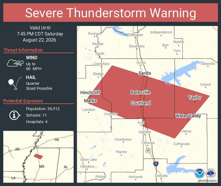
Severe Thunderstorm Warning Issued for Parts of Mississippi Until 7:45 p.m.
The National Weather Service in Memphis has issued a severe thunderstorm warning for southwestern Lafayette County, along with portions of Panola, northwestern Yalobusha, and east-central Quitman counties. The warning is in effect until 7:45 p.m. CDT, according to the agency.
The storm was located near Curtis Station, about 8 miles west of Batesville, as of 6:56 p.m. It is moving east at 40 mph. The storm is producing wind gusts up to 60 mph and quarter-sized hail, measuring about 1 inch in diameter.
Areas impacted include Taylor, the Sardis/Pope/Courtland corridor, Batesville, Water Valley, and sections of MS-315 and MS-7 south of Oxford. The storm may cause hail damage to vehicles, and wind could damage roofs, siding, and trees. Downed limbs could lead to isolated power outages, authorities said.
Residents are advised to take shelter in an interior room on the lowest floor, stay away from windows, and secure outdoor items. Drivers on I-55 between mile markers 229 and 252, and along MS-7, should slow down and be prepared for sudden heavy rain and hail. Officials warn against driving through flooded roads and advise turning around if roads are impassable.
Lafayette County remains under a severe thunderstorm watch until 10 p.m., with additional storms possible. The weather service recommends having multiple ways to receive alerts, including NOAA Weather Radio, Wireless Emergency Alerts, and trusted weather apps.
Source: Original Article